Filter Results

Loading..

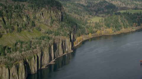
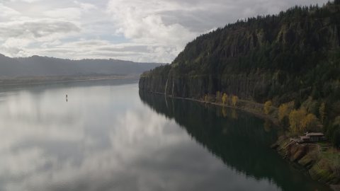
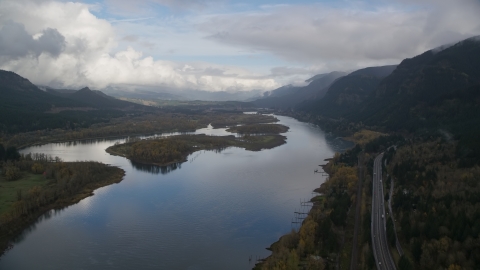
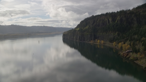
Washington Aerial Stock Photos - 150 Photos

150 results of Washington Aerial Stock Photos available in JPG | Page 1 of 3

Display
Thumbnails
Sort by
150 results found
AX154_211.0000254F - Aerial stock photo of The Washougal River and the Georgia Pacific Paper Mill in Camas, Washington

AX154_211.0000254F

AX153_173.0000150F - Aerial stock photo of Washougal High School and sports fields in Washougal, Washington

AX153_173.0000150F

AX153_185.0000000F - Aerial stock photo of The river in the Columbia River Gorge, Oregon

AX153_185.0000000F

AX153_138.0000000F - Aerial stock photo of I-205 Bridge spanning Columbia River in Vancouver, Washington

AX153_138.0000000F

AX154_204.0000156F - Aerial stock photo of Gause Elementary and the Washougal High School football field in Washougal, Washington

AX154_204.0000156F

AX154_038.0000311F - Aerial stock photo of Bonneville Dam structures in the Columbia River Gorge

AX154_038.0000311F

AX154_013.0000254F - Aerial stock photo of A train leaving Cape Horn Railroad Tunnel in Columbia River Gorge, Washington

AX154_013.0000254F

AX154_037.0000325F - Aerial stock photo of Bonneville Dam in Columbia River Gorge

AX154_037.0000325F

AX154_029.0000253F - Aerial stock photo of The Bonneville Dam structure in Columbia River Gorge

AX154_029.0000253F

AX153_155.0000018F - Aerial stock photo of School campuses and sports fields in Camas, Washington

AX153_155.0000018F

AX154_030.0000196F - Aerial stock photo of Bonneville Dam in the Columbia River Gorge

AX154_030.0000196F

AX153_159.0000263F - Aerial stock photo of Tract homes and the Washougal River in Washougal, Washington

AX153_159.0000263F

AX154_209.0000155F - Aerial stock photo of Gause Elementary, Washougal High School, and sports fields in Washougal, Washington

AX154_209.0000155F

AX154_195.0000171F - Aerial stock photo of Four waterfalls on steep green cliffs beside the Columbia River on the Washington side of Columbia River Gorge

AX154_195.0000171F

AX154_028.0000241F - Aerial stock photo of Bonneville Dam in the Columbia River, Columbia River Gorge

AX154_028.0000241F

AX153_145.0000185F - Aerial stock photo of A lumber mill on the Columbia River near Highway 14, Camas and Vancouver, Washington

AX153_145.0000185F

DXP001_018_0028 - Aerial stock photo of Winery buildings and grapevines at Maryhill Winery in Goldendale, Washington

DXP001_018_0028

AX154_069.0000000F - Aerial stock photo of Mt Adams' snowy summit in the distance and low cloud cover, Cascade Range, Oregon

AX154_069.0000000F

AX153_161.0000216F - Aerial stock photo of Small town neighborhoods in Washougal, Washington

AX153_161.0000216F

AX153_143.0000253F - Aerial stock photo of Suburban houses between Highway 14 and Columbia River, Vancouver, Washington

AX153_143.0000253F

AX153_149.0000054F - Aerial stock photo of High above Highway 14 looking out toward a paper mill in Camas, Washington

AX153_149.0000054F

AX154_029.0000000F - Aerial stock photo of Columbia River and the Bonneville Dam in Columbia River Gorge

AX154_029.0000000F

AX153_158.0000217F - Aerial stock photo of Tract Homes in the small town of Camas, Washington

AX153_158.0000217F

AX153_141.0000277F - Aerial stock photo of Suburban riverfront neighborhoods by Highway 14 in Vancouver, Washington

AX153_141.0000277F

AX154_210.0000271F - Aerial stock photo of Homes near the Washougal River and the Georgia Pacific Paper Mill in Camas, Washington

AX154_210.0000271F

AX153_149.0000224F - Aerial stock photo of High Above Suburban Homes Looking To Paper Mill, Camas, Washington

AX153_149.0000224F

AX154_034.0000246F - Aerial stock photo of The Bonneville Dam and the Columbia River in the Columbia River Gorge

AX154_034.0000246F

AX154_033.0000329F - Aerial stock photo of The Bonneville Dam in Columbia River Gorge

AX154_033.0000329F

AX153_143.0000000F - Aerial stock photo of Suburban homes between Highway 14 and Columbia River, Vancouver, Washington

AX153_143.0000000F

AX154_215.0000243F - Aerial stock photo of Highway 14 and the Columbia River near the I-205 Bridge in Vancouver, Washington

AX154_215.0000243F

AX153_179.0000000F - Aerial stock photo of A train traveling past open farm fields in Washougal, Washington

AX153_179.0000000F

AX154_177.0000071F - Aerial stock photo of The Bonneville Dam structures on the Columbia River in the Columbia River Gorge

AX154_177.0000071F

AX154_036.0000274F - Aerial stock photo of The Bonneville Dam in the Columbia River, Columbia River Gorge

AX154_036.0000274F

AX154_028.0000000F - Aerial stock photo of The Bonneville Dam and the Columbia River in the Columbia River Gorge

AX154_028.0000000F

AX153_178.0000113F - Aerial stock photo of A train traveling by fields and water in Washougal, Washington

AX153_178.0000113F

AX153_142.0000335F - Aerial stock photo of Highway 14 near suburban homes on the Columbia River in Vancouver, Washington

AX153_142.0000335F

AX153_141.0000021F - Aerial stock photo of Suburban riverfront houses by Highway 14 in Vancouver, Washington

AX153_141.0000021F

AX154_176.0000071F - Aerial stock photo of A view of the Bonneville Dam in the Columbia River Gorge

AX154_176.0000071F

AX153_177.0000272F - Aerial stock photo of Train traveling by fields in Washougal, Washington

AX153_177.0000272F

DXP001_019_0003 - Aerial stock photo of The Columbia River seen from steep cliffs in Goldendale, Washington

DXP001_019_0003

AX153_177.0000000F - Aerial stock photo of A train traveling by fields and country road in Washougal, Washington

AX153_177.0000000F

AX153_160.0000281F - Aerial stock photo of Strip mall near a suburban neighborhood in Washougal, Washington

AX153_160.0000281F

AX153_139.0000298F - Aerial stock photo of The I-205 Bridge over the Columbia River in Vancouver, Washington

AX153_139.0000298F

DXP001_018_0027 - Aerial stock photo of Miller Island and the Columbia River in Goldendale, Washington

DXP001_018_0027

AX153_142.0000206F - Aerial stock photo of Highway 14 and suburban homes on the Columbia River in Vancouver, Washington

AX153_142.0000206F

AX154_202.0000125F - Aerial stock photo of Washougal High School in Washougal, Washington

AX154_202.0000125F

AX153_158.0000000F - Aerial stock photo of Tract homes in the small town of Camas, Washington

AX153_158.0000000F

AX153_179.0000261F - Aerial stock photo of A train traveling past open fields in Washougal, Washington

AX153_179.0000261F

DXP001_019_0024 - Aerial stock photo of A view of Miller Island and the Columbia River seen from steep cliffs in Goldendale, Washington

DXP001_019_0024

AX154_195.0000295F - Aerial stock photo of Waterfalls on steep green cliffs beside the Columbia River on the Washington side of Columbia River Gorge

AX154_195.0000295F

AX154_008.0000156F - Aerial stock photo of An isolated home overlooking the river in Columbia River Gorge, Washington

AX154_008.0000156F

AX154_025.0000144F - Aerial stock photo of I-84 and islands in the Columbia River Gorge

AX154_025.0000144F

AX154_008.0000000F - Aerial stock photo of Isolated home beside the river in Columbia River Gorge, Washington

AX154_008.0000000F

DXP001_018_0019 - Aerial stock photo of The Maryhill Winery, amphitheater, and vineyards beside the Columbia River in Goldendale, Washington

DXP001_018_0019

AX153_176.0000111F - Aerial stock photo of Train traveling through countryside, Washougal, Washington

AX153_176.0000111F

AX153_185.0000354F - Aerial stock photo of The wide river in the Columbia River Gorge, Oregon

AX153_185.0000354F

AX154_218.0000275F - Aerial stock photo of I-205 Bridge and the Columbia River with godrays shining down, Vancouver, Washington

AX154_218.0000275F

AX154_004.0000307F - Aerial stock photo of Railroad tracks below a cliff in the Columbia River Gorge, Oregon

AX154_004.0000307F

AX154_027.0000278F - Aerial stock photo of Beacon Rock in the Columbia River Gorge, Skamania County, Washington

AX154_027.0000278F

AX154_195.0000000F - Aerial stock photo of Four waterfalls on steep green cliffs and Columbia River on the Washington side of Columbia River Gorge

AX154_195.0000000F

150 results found
New   Save View   Add All Clear All Untitled Playlist(0)