Filter Results

Loading..

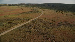
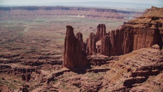
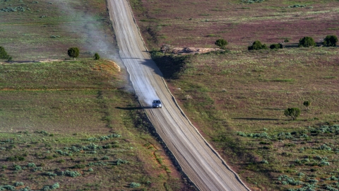
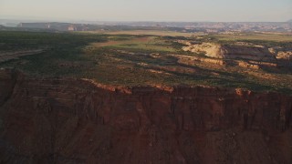
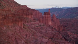
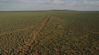
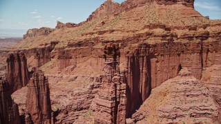
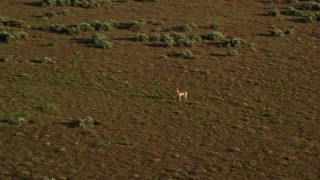
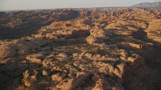
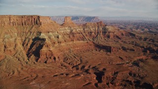
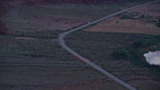
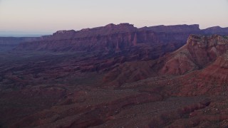
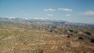
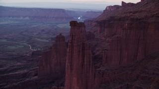
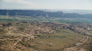
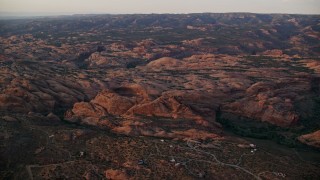
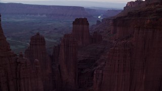
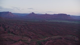
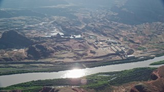
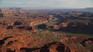
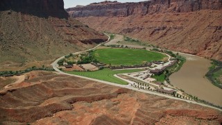
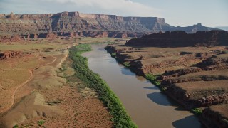
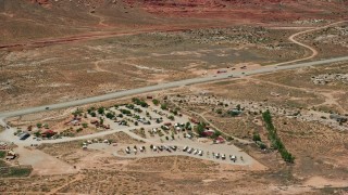
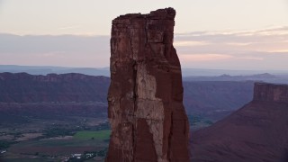
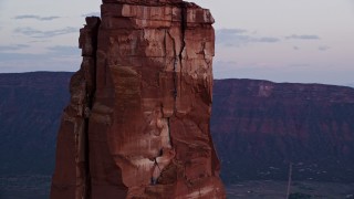
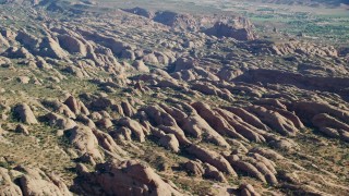
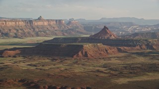
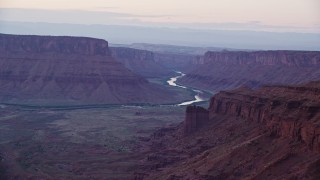
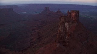
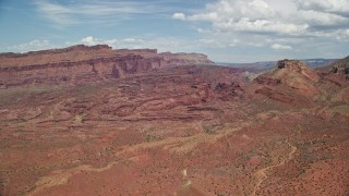
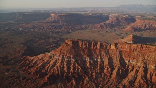
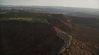
Moab, Utah Aerial Stock Footage and Photos - 199 Results

199 results of Moab, Utah Aerial Stock Video Footage and Photos available in 5.5K RAW, 4K, 4K UHD H264 & 4K LOG | Page 1 of 4

Display
Thumbnails
Sort by
199 results found
AX136_271E - 5.5K aerial stock footage of bird's eye view of potash ponds in a desert valley, Moab, Utah

AX136_271E

AX137_122E - 5.5K aerial stock footage of flying over dirt path through canyon in Fisher Towers, Utah

AX137_122E

AX137_106E - 5.5K aerial stock footage of approaching The Titan rock formation at Fisher Towers, Utah

AX137_106E

AX137_115E - 5.5K aerial stock footage of orbiting rock climbers on a formation at Fisher Towers, Utah

AX137_115E

AX138_059E - 5.5K aerial stock footage fly over Colorado River and approach Pyramid Butte, Moab, Utah

AX138_059E

AX137_103E - 5.5K aerial stock footage of orbiting The Titan near other rock formations at Fisher Towers, Utah

AX137_103E

AX138_217E - 5.5K aerial stock footage of tracking pronghorn running through the desert near Moab, Utah

AX138_217E

AX138_172E - 5.5K aerial stock footage of flying toward the United Nations Tablet butte in Moab, Utah

AX138_172E

AX138_223.0000169 - Aerial stock photo of A silver SUV with a trail of dust on Hatch Point Road, Moab, Utah

AX138_223.0000169

AX138_410E - 5.5K aerial stock footage of passing by buttes and Castleton Tower, Moab, Utah, sunset

AX138_410E

AX138_223.0000000 - Aerial stock photo of A silver SUV on Hatch Point Road in Moab, Utah

AX138_223.0000000

AX138_223.0000115 - Aerial stock photo of Silver SUV trailing a plume of dust on a desert road, Moab, Utah

AX138_223.0000115

AX138_223.0000014 - Aerial stock photo of A view of a silver SUV on Hatch Point Road, Moab, Utah

AX138_223.0000014

AX138_223.0000041 - Aerial stock photo of A silver SUV leaving a trail of dust on Hatch Point Road, Moab, Utah

AX138_223.0000041

AX138_224 - 5.5K aerial stock footage track a pronghorn racing away near Moab, Utah

AX138_224

AX138_223.0000047 - Aerial stock photo of Silver SUV trailing a plume of dust on Hatch Point Road, Moab, Utah

AX138_223.0000047

AX138_155E - 5.5K aerial stock footage approach and tilt to cars parked on Dead Horse Point Overlook with view of Canyonlands National Park, Utah

AX138_155E

AX139_020E - 5.5K aerial stock footage of tracking Cessna taking off from runway, Canyonlands Field, Utah

AX139_020E

AX137_118E - 5.5K aerial stock footage of a couple of rock climbers on a rock formation at Fisher Towers, Utah

AX137_118E

AX138_397E - 5.5K aerial stock footage of passing the Colorado River with view of distant mesas, revealing Red Cliffs Lodge, Moab, Utah, sunset

AX138_397E

AX137_088E - 5.5K aerial stock footage fly over Dry Mesa vegetation revealing buttes and Parriott Mesa, Moab, Utah

AX137_088E

AX136_288 - 5.5K aerial stock footage of flying by Archview RV & Resort Campground by Highway 191, Moab, Utah

AX136_288

AX138_424 - 5.5K aerial stock footage of circling around rock climbers on Castleton Tower, Moab, Utah, sunset

AX138_424

AX138_030 - 5.5K aerial stock footage of a wide view of a desert landscape, canyon and mesas, Moab, Utah

AX138_030

AX139_016E - 5.5K aerial stock footage of a skydiver landing in Canyonlands Field, Utah

AX139_016E

AX138_457E - 5.5K aerial stock footage track SUV, two sedans on State Route 128, Moab, Utah, twilight

AX138_457E

AX138_212E - 5.5K aerial stock footage of Hatch Point Road through open desert in Moab, Utah

AX138_212E

AX137_001E - 5.5K aerial stock footage of passing by Highway 191 through desert valley, Moab, Utah

AX137_001E

AX138_183E - 5.5K aerial stock footage fly through gap between United Nations Tablet butte and cliffs to reveal Canyonlands National Park, Utah

AX138_183E

AX138_175E - 5.5K aerial stock footage orbit small butte with wide view of Canyonlands National Park, Utah

AX138_175E

AX138_423 - 5.5K aerial stock footage of an orbit around a rock climber on Castleton Tower, Moab, Utah, sunset

AX138_423

AX138_055E - 5.5K aerial stock footage of Intrepid Potash factory on a bank of the Colorado River, Moab, Utah

AX138_055E

AX138_040 - 5.5K aerial stock footage of a small desert town, Moab, Utah

AX138_040

AX136_268E - 5.5K aerial stock footage of flying toward potash ponds in a desert valley, Moab, Utah

AX136_268E

AX138_062 - 5.5K aerial stock footage of sun shining on potash ponds with butte and mesa behind them, Moab, Utah

AX138_062

AX138_215E - 5.5K aerial stock footage of a bend in Hatch Point Road through the desert near Moab, Utah

AX138_215E

AX138_439E - 5.5K aerial stock footage fly past Ancient Art, reveal Echo Tower, The Titan at Fisher Towers, Utah, twilight

AX138_439E

AX137_155E - 5.5K aerial stock footage orbit Red Cliffs Lodge hotel in Moab, Utah

AX137_155E

AX139_014E - 5.5K aerial stock footage of tracking a skydiver landing in a field, Canyonlands Field, Utah

AX139_014E

AX138_417E - 5.5K aerial stock footage orbit Castleton Tower in Moab, Utah, at sunset

AX138_417E

AX138_228E - 5.5K aerial stock footage fly over open desert and dirt road near Moab, Utah

AX138_228E

AX138_341E - 5.5K aerial stock footage of orbiting a butte near Lockhart Canyon, Moab, Utah, sunset

AX138_341E

AX137_101E - 5.5K aerial stock footage of Ancient Art, Echo Tower, Cottontail Tower, The Titan rock formations, Fisher Towers, Utah

AX137_101E

AX138_369E - 5.5K aerial stock footage of flying over box canyon and rock formations, Moab, Utah, sunset

AX138_369E

AX138_348E - 5.5K aerial stock footage of passing by cliffs in Lockhart Canyon, Moab, Utah, sunset

AX138_348E

AX138_267E - 5.5K aerial stock footage of circling North Six-Shoter Peak, Moab, Utah

AX138_267E

AX138_449E - 5.5K aerial stock footage of giant desert buttes across valley, Moab, Utah, twilight

AX138_449E

AX137_110E - 5.5K aerial stock footage fly away from The Titan and other rock formations at Fisher Towers, Utah

AX137_110E

AX138_007E - 5.5K aerial stock footage of a bird's eye of a desert road by the Colorado River in Moab, Utah

AX138_007E

AX138_004E - 5.5K aerial stock footage tilt to bird's eye view of Red Cliffs Lodge beside the Colorado River in Moab, Utah

AX138_004E

AX138_350E - 5.5K aerial stock footage approach and fly over dirt road near rock formations on Hatch Point, Moab, Utah, sunset

AX138_350E

AX138_210E - 5.5K aerial stock footage of a bird's eye view of the top of canyon cliff and then fly away in Moab, Utah

AX138_210E

AX138_192E - 5.5K aerial stock footage approach and tilt to rock formation on a cliff in Moab, Utah

AX138_192E

AX138_262E - 5.5K aerial stock footage of passing by South Six-Shooter Peak in a hazy desert valley, Moab, Utah

AX138_262E

AX136_283E - 5.5K aerial stock footage of Highway 191 through a desert valley, Moab, Utah

AX136_283E

AX137_114 - 5.5K aerial stock footage of circling The Titan and nearby rock formations at Fisher Towers, Utah

AX137_114

AX138_034E - 5.5K aerial stock footage of a view of petrified sand dunes at Sand Flats Recreation Area, Moab, Utah

AX138_034E

AX137_113 - 5.5K aerial stock footage approach The Titan and nearby rock formations at Fisher Towers, Utah

AX137_113

AX138_231 - 5.5K aerial stock footage of tracking a lone pronghorn running through the desert near Moab, Utah

AX138_231

AX138_063E - 5.5K aerial stock footage follow Colorado River toward a mesa, Moab, Utah

AX138_063E

199 results found
New   Save View   Add All Clear All Untitled Playlist(0)